
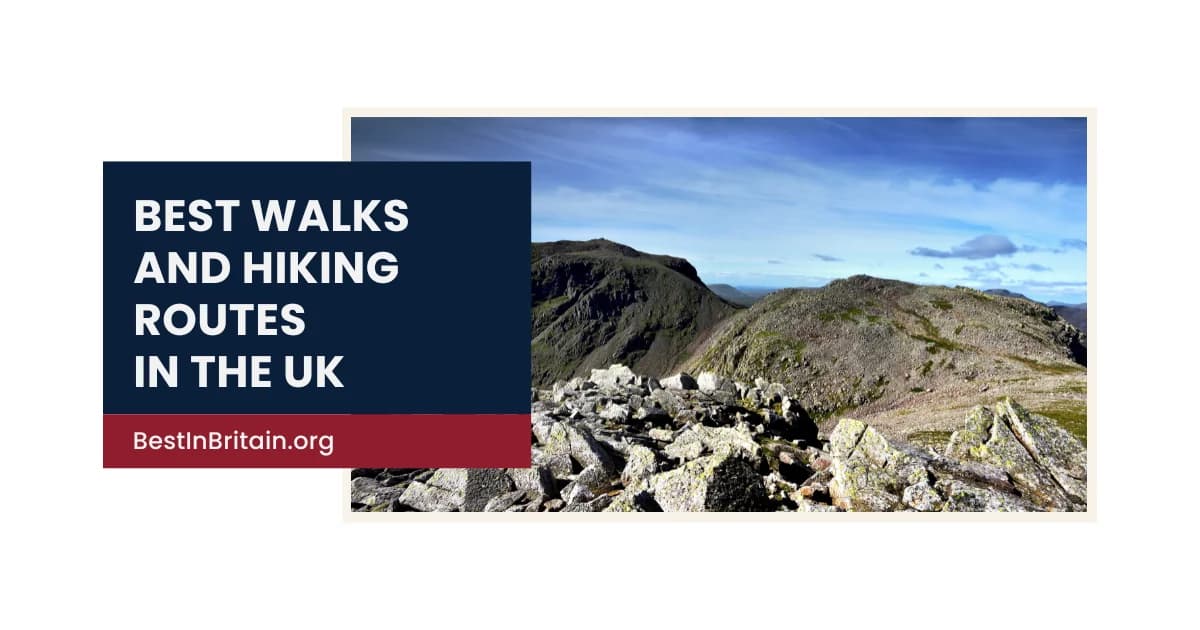
The United Kingdom offers an exceptional variety of walking landscapes within a relatively compact area. High mountain ridges, glacial valleys, open moorland, limestone dales, forest paths, loch shores and long-distance trails all provide very different ways to experience the country on foot.
The best walk is not always the highest or most difficult. A short ridge, lakeside circuit or historic trail can be as memorable as a full mountain day when the route has a clear sense of place. Weather, terrain, navigation and fitness matter far more than distance alone, particularly in the mountains of Scotland, Wales and northern England.
This guide brings together 30 of the best walks and hiking routes in the UK. It is not a rigid ranking. Instead, it highlights routes that stand out for their scenery, character and overall walking experience across England, Scotland, Wales and Northern Ireland.
Best walks and hiking routes in England
1. Climb Scafell Pike from Wasdale
Route: Wasdale Head, Lake District
Walk details:
- Approximate distance: 6 miles return
- Difficulty: Challenging
- Recommended duration: 5 to 7 hours
Price: Free, with parking charges
Scafell Pike is England’s highest mountain and one of the country’s most recognised hiking objectives.
The Wasdale route is the most direct ascent, climbing steeply from the valley towards the summit plateau. Views extend across the central fells in clear weather, but mist can make the upper mountain confusing and navigation-intensive.
The route is physically demanding despite its relatively short distance.
Pro tip:
Carry a map and compass and do not rely on following other walkers, especially in poor visibility.
2. Walk the Helvellyn ridge via Striding Edge
Route: Glenridding, Lake District
Walk details:
- Approximate distance: 8 miles
- Difficulty: Challenging, with exposed scrambling
- Recommended duration: 6 to 8 hours
Price: Free, with parking charges
Helvellyn via Striding Edge is one of England’s classic mountain days.
The route climbs from Glenridding before crossing a narrow, exposed ridge to the summit of Helvellyn. The return often uses Swirral Edge, creating a dramatic horseshoe with extensive views across the eastern Lake District.
This is not suitable for inexperienced walkers in strong wind, ice or poor visibility.
Pro tip:
Choose a non-ridge alternative if conditions are poor or anyone in the group is uncomfortable with exposure.
3. Walk the Mam Tor ridge
Route: Castleton, Peak District
Walk details:
- Approximate distance: 5 miles
- Difficulty: Moderate
- Recommended duration: 2 to 4 hours
Price: Free, with parking charges
Mam Tor provides one of the Peak District’s strongest short ridge walks.
The route climbs above Castleton before following an open ridge with views across the Hope Valley, Edale and the surrounding moors. It offers a satisfying sense of height without the technical demands of a major mountain.
The exposed ridge can feel much colder and windier than the valley.
Pro tip:
Start early and continue beyond the summit along the ridge for a more complete walk than a quick out-and-back.
4. Hike Pen-y-ghent
Route: Horton-in-Ribblesdale, Yorkshire Dales
Walk details:
- Approximate distance: 6 miles
- Difficulty: Moderate to challenging
- Recommended duration: 3 to 5 hours
Price: Free, with parking charges
Pen-y-ghent is one of the Yorkshire Three Peaks and an excellent introduction to upland walking in the Dales.
The route climbs steadily from Horton-in-Ribblesdale before a steeper final ascent to the summit. Limestone scenery, broad views and a clear sense of progression make it especially rewarding.
The upper slopes are exposed and can become slippery in poor weather.
Pro tip:
Walk the standard circuit rather than returning the same way, and allow time to explore Horton afterwards.
5. Walk Malham Cove and Gordale Scar
Route: Malham, Yorkshire Dales
Walk details:
- Approximate distance: 7 miles
- Difficulty: Moderate
- Recommended duration: 3 to 5 hours
Price: Free, with parking charges
This circuit combines several of the Yorkshire Dales’ most distinctive limestone landscapes.
Malham Cove, the limestone pavement, Gordale Scar and Janet’s Foss all appear within one route, creating exceptional variety over a manageable distance. The walk is popular for good reason, though the main sites can become crowded.
Some paths are rocky and slippery after rain.
Pro tip:
Complete the full circuit rather than visiting only the cove, and start early on weekends.
6. Walk the Catbells circuit
Route: Near Keswick, Lake District
Walk details:
- Approximate distance: 4 miles
- Difficulty: Moderate
- Recommended duration: 2 to 4 hours
Price: Free, with parking or boat charges
Catbells is one of the Lake District’s most rewarding shorter fell walks.
The route climbs quickly above Derwentwater, providing broad views towards Keswick, Borrowdale and the surrounding fells. Short rocky sections add interest without turning the walk into a major scramble.
Its accessibility makes it extremely popular.
Pro tip:
Use the Keswick Launch or local bus to reduce parking pressure and begin outside the busiest period.
7. Follow the Stanage Edge path
Route: Near Hathersage, Peak District
Walk details:
- Approximate distance: 6 miles
- Difficulty: Moderate
- Recommended duration: 3 to 4 hours
Price: Free, with parking charges
Stanage Edge provides a long gritstone ridge with exceptional views across the Peak District.
The route follows the escarpment above moorland and farmland, passing climbing areas and dramatic rock formations. It is less about reaching one summit than enjoying a sustained elevated walk.
Wind and poor visibility can make the exposed edge feel severe.
Pro tip:
Combine the edge with a return through lower woodland or moorland for greater variety.
8. Walk the South Downs from Ditchling Beacon to Devil’s Dyke
Route: East Sussex
Walk details:
- Approximate distance: 9 miles
- Difficulty: Moderate
- Recommended duration: 4 to 6 hours
Price: Free
This section of the South Downs Way offers broad chalk landscapes and some of the finest ridge walking in southern England.
The route crosses open downland with long views towards the coast and Weald. It is relatively straightforward underfoot but exposed to wind, sun and changing weather.
Public transport allows the walk to be completed one way.
Pro tip:
Carry water because shade and services are limited along the ridge.
9. Walk the Lizard Peninsula circuit
Route: Lizard village, Cornwall
Walk details:
- Approximate distance: 7 miles
- Difficulty: Moderate
- Recommended duration: 3 to 5 hours
Price: Free
The Lizard Peninsula combines dramatic coastal scenery with one of the southernmost walking routes in mainland Britain.
Cliffs, coves, lighthouse views and open Atlantic exposure create a route rich in geology and wildlife. The circuit also passes close to villages and cafés, making it easier to plan than some remote coastal walks.
The cliff paths can be slippery and exposed.
Pro tip:
Walk clockwise or anticlockwise according to wind direction so the most exposed section feels manageable.
10. Explore Kinder Scout from Edale
Route: Edale, Peak District
Walk details:
- Approximate distance: 8 to 10 miles
- Difficulty: Challenging
- Recommended duration: 5 to 7 hours
Price: Free, with parking charges
Kinder Scout is one of England’s most important upland landscapes and a landmark in the history of public access.
Routes from Edale climb onto a broad peat plateau with gritstone edges, waterfalls and expansive moorland. Navigation becomes difficult in mist because the plateau lacks one obvious summit.
The terrain can be wet, eroded and physically demanding.
Pro tip:
Choose a clear route around the edge and carry proper navigation even if the path appears busy at the start.
11. Walk Hadrian’s Wall from Housesteads to Steel Rigg
Route: Northumberland
Walk details:
- Approximate distance: 8 miles
- Difficulty: Moderate
- Recommended duration: 4 to 6 hours
Price: Free path access, with charges for heritage sites
This is one of the most dramatic sections of Hadrian’s Wall Path.
The route follows the Roman frontier across crags, past milecastles and towards Sycamore Gap and Steel Rigg. History and landscape remain visible throughout, making the walk especially rewarding for visitors who want more than scenery alone.
Repeated short climbs make the route more tiring than the distance suggests.
Pro tip:
Use the seasonal bus or arrange transport so you can complete the section one way.
12. Walk around Ullswater from Aira Force to Glenridding
Route: Ullswater, Lake District
Walk details:
- Approximate distance: 7 miles
- Difficulty: Moderate
- Recommended duration: 3 to 5 hours
Price: Free, with parking or boat charges
This route combines woodland, waterfalls and lakeshore walking on the eastern side of Ullswater.
Aira Force provides a dramatic opening before the path continues through quieter woodland and shoreline sections towards Glenridding. It offers a lower-level alternative to the surrounding fells while retaining strong mountain views.
The route can be muddy after rain.
Pro tip:
Use the steamer or local bus to create a one-way walk and avoid retracing the route.
Best walks and hiking routes in Scotland
13. Climb Ben Nevis via the Mountain Track
Route: Fort William, Highlands
Walk details:
- Approximate distance: 10.5 miles
- Difficulty: Challenging
- Recommended duration: 7 to 9 hours
Price: Free, with parking charges
Ben Nevis is the highest mountain in the UK and one of Scotland’s most popular major hikes.
The Mountain Track climbs steadily from Glen Nevis to the summit plateau, where conditions can remain cold, wet and difficult even when the valley is calm. In clear weather, the views extend across the western Highlands.
The final plateau requires careful navigation in poor visibility.
Pro tip:
Carry full mountain equipment and turn back if conditions deteriorate beyond your experience.
14. Walk the Buachaille Etive Mòr circuit
Route: Glencoe, Highlands
Walk details:
- Approximate distance: 8 miles
- Difficulty: Challenging
- Recommended duration: 7 to 9 hours
Price: Free
Buachaille Etive Mòr is one of Scotland’s most recognisable mountains and provides a classic Highland circuit.
The route climbs steeply into Coire na Tulaich before crossing two Munro summits and descending through Lairig Gartain. Views over Rannoch Moor, Glen Etive and Glencoe are exceptional.
This is a serious mountain day with steep ground and demanding navigation.
Pro tip:
Attempt the route only in suitable weather and use an alternative descent if the main corrie is unsafe.
15. Hike the Quiraing circuit
Route: Isle of Skye
Walk details:
- Approximate distance: 4 miles
- Difficulty: Moderate to challenging
- Recommended duration: 3 to 4 hours
Price: Free, with parking charges
The Quiraing is one of the most distinctive walking landscapes in Scotland.
The circuit passes beneath cliffs and pinnacles before climbing onto higher ground with views across Trotternish and the sea. It combines unusual geology with one of Skye’s strongest panoramic walks.
The terrain is rough and can become slippery or exposed in poor conditions.
Pro tip:
Start early and complete the full circuit only when visibility and wind are suitable.
16. Walk Arthur’s Seat and Salisbury Crags
Route: Edinburgh, Scotland
Walk details:
- Approximate distance: 3 to 4 miles
- Difficulty: Moderate
- Recommended duration: 2 to 3 hours
Price: Free
Arthur’s Seat provides one of the best urban hikes in the UK.
The route rises from Holyrood Park above the centre of Edinburgh, with views across the Old Town, Firth of Forth and surrounding hills. Salisbury Crags adds a dramatic alternative perspective on the city.
Despite the urban location, the summit can be windy and slippery.
Pro tip:
Use the broader paths in poor weather and avoid scrambling on wet rock.
17. Climb Ben Lomond
Route: Rowardennan, Loch Lomond
Walk details:
- Approximate distance: 7.5 miles
- Difficulty: Challenging
- Recommended duration: 5 to 7 hours
Price: Free, with parking charges
Ben Lomond is one of Scotland’s most accessible Munros and a classic first major mountain.
The route climbs above Loch Lomond before reaching a broad summit ridge with views across the southern Highlands. A rougher return via Ptarmigan creates a more satisfying circuit for experienced walkers.
Popularity should not disguise the seriousness of the upper mountain in poor weather.
Pro tip:
Use the main path for descent if the Ptarmigan ridge is beyond your experience or conditions are poor.
18. Walk from Kinlochleven to Fort William on the West Highland Way
Route: Kinlochleven to Fort William, Highlands
Walk details:
- Approximate distance: 15 miles
- Difficulty: Challenging
- Recommended duration: 7 to 9 hours
Price: Free
The final stage of the West Highland Way provides a memorable long-distance walking experience.
The route climbs from Kinlochleven before crossing open moorland and descending through Glen Nevis towards Fort William. Mountain views and the sense of completion make it one of the trail’s strongest sections.
The distance and exposed terrain require good fitness and preparation.
Pro tip:
Arrange accommodation or transport in advance and carry enough food and water for a full day.
19. Walk the Old Man of Storr
Route: Trotternish, Isle of Skye
Walk details:
- Approximate distance: 3 miles
- Difficulty: Moderate
- Recommended duration: 2 to 3 hours
Price: Free, with parking charges
The Old Man of Storr is one of the most recognisable rock formations in Scotland.
The path climbs steadily through open ground to a dramatic landscape of pinnacles and cliffs. Views towards the sea and across northern Skye become increasingly impressive with height.
The route is short but steep, muddy and extremely busy in peak periods.
Pro tip:
Arrive early and continue beyond the first viewpoint for a fuller perspective on the landscape.
20. Hike the Cairngorm plateau from the ski centre
Route: Cairngorm Mountain, near Aviemore
Walk details:
- Approximate distance: 7 miles
- Difficulty: Challenging
- Recommended duration: 5 to 7 hours
Price: Free, with parking charges
A walk onto the Cairngorm plateau reveals one of the UK’s most severe and unusual mountain environments.
Routes from the ski centre can reach Cairn Gorm and continue across broad high ground with views over the northern Cairngorms. The plateau feels expansive and remote despite the accessible starting point.
Weather can become dangerous very quickly, especially in winter or poor visibility.
Pro tip:
Carry winter equipment when conditions require it and avoid treating the ski-centre access as proof that the mountain is easy.
Best walks and hiking routes in Wales
21. Climb Yr Wyddfa via the Pyg Track
Route: Pen-y-Pass, Eryri
Walk details:
- Approximate distance: 7 miles return
- Difficulty: Challenging
- Recommended duration: 5 to 7 hours
Price: Free, with transport or parking charges
The Pyg Track is one of the most popular routes to the summit of Yr Wyddfa, the highest mountain in Wales.
The path climbs above lakes and glacial valleys before joining steeper ground towards the summit ridge. Clear weather reveals exceptional views across Eryri, but cloud and wind can make the upper mountain difficult.
Parking at Pen-y-Pass is heavily restricted.
Pro tip:
Use park-and-ride or public transport and avoid joining the route without proper mountain clothing.
22. Walk the Cadair Idris Minffordd Path
Route: Minffordd, southern Eryri
Walk details:
- Approximate distance: 6 miles
- Difficulty: Challenging
- Recommended duration: 5 to 7 hours
Price: Free, with parking charges
Cadair Idris offers one of the finest mountain circuits in Wales.
The Minffordd Path climbs steeply past waterfalls and into a dramatic corrie before reaching the summit ridge. The route feels compact but intense, with strong views towards the coast and surrounding mountains.
Steep ground and rapid weather changes make it a serious hike.
Pro tip:
Allow extra time for the descent, which can feel longer and harder after the steep ascent.
23. Hike Pen y Fan via the horseshoe
Route: Bannau Brycheiniog National Park
Walk details:
- Approximate distance: 10 miles
- Difficulty: Challenging
- Recommended duration: 5 to 7 hours
Price: Free, with parking charges
The full Pen y Fan horseshoe offers a stronger mountain experience than the short popular route from Storey Arms.
The circuit includes broad ridges, several summits and expansive views across Bannau Brycheiniog. It provides a much clearer sense of the surrounding landscape and avoids reducing Pen y Fan to a quick summit visit.
The ridges are exposed and can be confusing in cloud.
Pro tip:
Choose the full horseshoe only with suitable fitness and navigation skills.
24. Walk the Glyderau via Devil’s Kitchen
Route: Ogwen Valley, Eryri
Walk details:
- Approximate distance: 6 to 8 miles depending on the route
- Difficulty: Challenging
- Recommended duration: 6 to 8 hours
Price: Free, with parking or transport charges
The Glyderau contain some of the most dramatic rocky mountain scenery in Wales.
Routes through Devil’s Kitchen climb steeply from Llyn Idwal towards high, rugged plateaus and summit formations. The terrain feels more severe and alpine than many British mountains.
Loose rock, steep ground and poor visibility all require care.
Pro tip:
Use public transport to the Ogwen Valley where possible and avoid the route in high wind or ice without appropriate experience.
25. Walk the Preseli Hills from Foel Eryr
Route: Preseli Hills, Pembrokeshire
Walk details:
- Approximate distance: 5 to 8 miles depending on the circuit
- Difficulty: Moderate
- Recommended duration: 3 to 5 hours
Price: Free
The Preseli Hills provide a quieter upland walk above the better-known Pembrokeshire coast.
Open moorland, ancient tracks and long views towards the sea create a landscape rich in archaeology and atmosphere. The hills are lower than Eryri but still exposed to fast-changing weather.
The route is especially rewarding for walkers seeking space and history rather than a famous summit.
Pro tip:
Carry a map because paths can be indistinct across open moorland.
26. Walk the Brecon Beacons Waterfall Country circuit
Route: Near Ystradfellte, Bannau Brycheiniog
Walk details:
- Approximate distance: 8 to 10 miles
- Difficulty: Moderate to challenging
- Recommended duration: 4 to 6 hours
Price: Free, with parking charges
Waterfall Country combines woodland, rivers and a sequence of dramatic waterfalls.
The full circuit can include Sgŵd yr Eira and several other falls linked by steep, muddy and often slippery paths. It offers a completely different experience from the open ridges elsewhere in Bannau Brycheiniog.
Heavy rain increases both the spectacle and the difficulty.
Pro tip:
Wear waterproof footwear and expect slower progress around steep steps and wet rock.
Best walks and hiking routes in Northern Ireland
27. Climb Slieve Donard
Route: Newcastle, County Down
Walk details:
- Approximate distance: 6 miles
- Difficulty: Challenging
- Recommended duration: 5 to 7 hours
Price: Free, with parking charges
Slieve Donard is the highest mountain in Northern Ireland and rises directly above the coast.
The route climbs through forest before following the Mourne Wall towards the summit. Clear weather provides broad views across the Irish Sea and surrounding peaks.
The upper mountain is exposed and can become difficult in wind or mist.
Pro tip:
Start early and carry proper navigation even though the Mourne Wall provides a clear feature for much of the route.
28. Walk the Mourne Wall from Silent Valley
Route: Silent Valley, County Down
Walk details:
- Approximate distance: 7 to 10 miles depending on the circuit
- Difficulty: Moderate to challenging
- Recommended duration: 4 to 6 hours
Price: Free, with possible parking charges
The Mourne Wall provides one of Northern Ireland’s most distinctive upland walking features.
Routes from Silent Valley combine reservoir scenery, granite mountains and long sections beside the historic wall. The landscape feels more remote than the distance from nearby towns suggests.
There are multiple route options, so navigation and planning are important.
Pro tip:
Choose a circuit suited to the forecast and avoid committing to a high ridge in poor visibility.
29. Walk the Divis and Black Mountain circuit
Route: Belfast, Northern Ireland
Walk details:
- Approximate distance: 4 to 6 miles
- Difficulty: Easy to moderate
- Recommended duration: 2 to 4 hours
Price: Free, with parking charges
Divis and Black Mountain offer one of the UK’s best city-edge walking experiences.
The route rises above Belfast with views across the city, Belfast Lough and surrounding countryside. It provides open moorland walking without requiring a long journey into the mountains.
The area is exposed and can feel much colder than the city below.
Pro tip:
Visit in clear weather for the best views and carry layers even on a mild day.
30. Walk the Cuilcagh Boardwalk Trail
Route: County Fermanagh
Walk details:
- Approximate distance: 7 miles return
- Difficulty: Moderate
- Recommended duration: 3 to 5 hours
Price: Free, with possible parking charges
The Cuilcagh Boardwalk Trail crosses blanket bog before climbing towards the slopes of Cuilcagh Mountain.
The raised boardwalk protects the peatland and creates a distinctive walking experience across open countryside. The final stepped section provides broad views over the surrounding lakelands in clear conditions.
The route is exposed and the boardwalk can become slippery.
Pro tip:
Book parking where required and avoid leaving the boardwalk across sensitive peatland.
How to plan a walk or hike in the UK
The distance of a route tells only part of the story. A six-mile mountain walk with steep ground, poor paths and high exposure can be more demanding than a fifteen-mile lowland trail. Elevation, terrain, weather and navigation should all shape the decision.
Mountain forecasts are more important than general city weather. Ben Nevis, Cairngorm, Yr Wyddfa, Helvellyn and the Mournes can experience strong wind, low cloud and cold temperatures even when nearby valleys appear calm.
Carry a map, compass, food, water, waterproof clothing and a charged phone on serious routes. A phone is useful, but it should not be the only navigation method because batteries fail and mobile signal can disappear.
Winter transforms many routes completely. Snow and ice on Striding Edge, the Cairngorm plateau, Ben Nevis or the Glyderau require specialist equipment and skills. Walkers without that experience should choose a lower route or wait for safer conditions.
Public transport can improve many walking days. Edale, Horton-in-Ribblesdale, Keswick, Pen-y-Pass, Glenridding and sections of national trails all offer alternatives to relying entirely on a car. One-way walks are often more rewarding than returning along the same path.
Respect the landscape by following access guidance, closing gates, controlling dogs around livestock and taking all litter away. Peatland, dunes, summit vegetation and eroded paths are especially vulnerable to heavy footfall.
The best route depends on experience and purpose. Scafell Pike, Ben Nevis, Yr Wyddfa and Slieve Donard provide major summit days; Mam Tor, Catbells and Arthur’s Seat offer strong views with less commitment; and Malham, Waterfall Country and Hadrian’s Wall combine landscape with geology or history. A good walk is one that matches the group, the conditions and the time available.
Related guides
Business Services
20 best islands in the UK to visit for a memorable escape
Discover the best islands across the United Kingdom, from the Hebrides and northern archipelagos to Welsh coastal islands, English island escapes and dramatic island landscapes in Northern Ireland.
Updated 25 September 2026
Business Services
20 best forests and woodlands in the UK for a memorable escape
Discover the best forests and woodlands across the United Kingdom, from ancient royal hunting grounds and Highland pinewoods to mountain-biking forests, wildlife reserves and peaceful woodland walks.
Updated 17 July 2026
Business Services
25 best coastal walks in the UK for unforgettable sea views
Discover the best coastal walks across the United Kingdom, from dramatic clifftop routes and island paths to sandy bays, historic headlands and some of the finest sections of Britain’s long-distance coast trails.
Updated 9 July 2026

Business Services
25 best gardens in the UK for a memorable visit
Discover the best gardens across the United Kingdom, from great botanical collections and formal historic gardens to experimental planting, woodland gardens and outstanding landscape design.
Updated 30 June 2026
Business Services
15 best road trips in the UK for an unforgettable journey
Discover the best road trips across the United Kingdom, from Scotland’s North Coast 500 and Wales’s mountain routes to coastal drives through Cornwall, Northern Ireland and some of England’s most scenic landscapes.
Updated 28 June 2026

Business Services
Best painters and decorators in Edinburgh
A practical guide to Edinburgh painters and decorators for interior painting, exterior work, wallpapering, period properties, commercial projects and complete renovations.
Updated 3 August 2026
Know a business we should consider?
Send us the details and our editorial team will review whether it fits a future guide.
Submit businessWriter profile
George Davies
Regional and city guide desk researcher
George researches location-led guides, city roundups, regional comparisons, attractions, and practical local recommendations.
Editorial Trust Standard
Independent ReviewIndependent Research
Featured rankings are editorially determined. Commercial partner listings are strictly labeled as Sponsored or Featured.
Public Register Audit
Listings are cross-checked against public regulatory registries, Companies House filings, and published fee schedules.